AITScan™ Aerial Services
Our aerial services provide infrared solutions for a variety of problems including roof moisture, steam leaks, pollution, and more. Check out each service below to learn more!
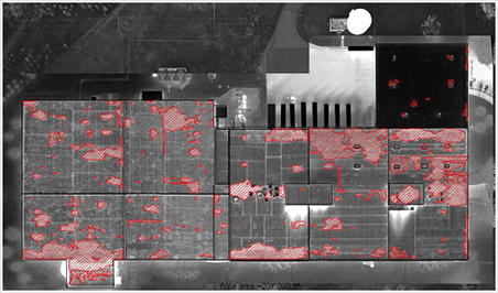
Roof Moisture FindIR™
Detect Roof Leakage and Moisture Contamination
Roof Moisture FindIR™ provides innovative methods for detecting hard-to-spot waterproofing problems for large facilities.
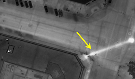
Steam Leak FindIR™
Detect/Pinpoint Leaks in your Steam Distribution System
Steam Leak FindIR™ provides an efficient and cost-effective way to spot steam leak issues, allowing for energy savings
Pollution FindIR™
Identify and Locate Sources of Water Contamination.
Pollution FindIR™ provides a cost-effective way to identify and determine exact locations of pollutants from a variety of sources.
Animal FindIR™
Count and Identify Animal Types Within a Habitat
Animal FindIR™ allows us to quickly and effectively count and identify a variety of animal types within all different types of habitats.
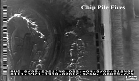
LandFill Fire FindIR™
Detect and Locate Subsurface Landfill Fires
LandFillFire FindIR™ allows thermographers to detect and pinpoint the exact location and extent of hazardous sub-surface landfill fires. Early detection is key to preventing serious environmental problems due to fire.
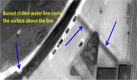
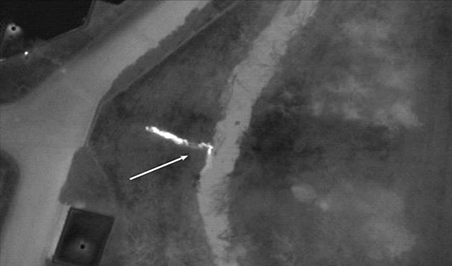
HTHW Leak FindIR™
Finds Leaks and Improper Insulation in HTHW, MTHW, and LTHW System Lines
HTHW Leak FindIR™ allows our thermographers to clearly pinpoint problem areas for underground system lines. Discovery of these problem areas can lead to long-term energy savings.